Blog

Moonshadow and DKS Pre-Launch Trial of DB4IoT with INRIX Trip Paths

By |May 31st, 2019|

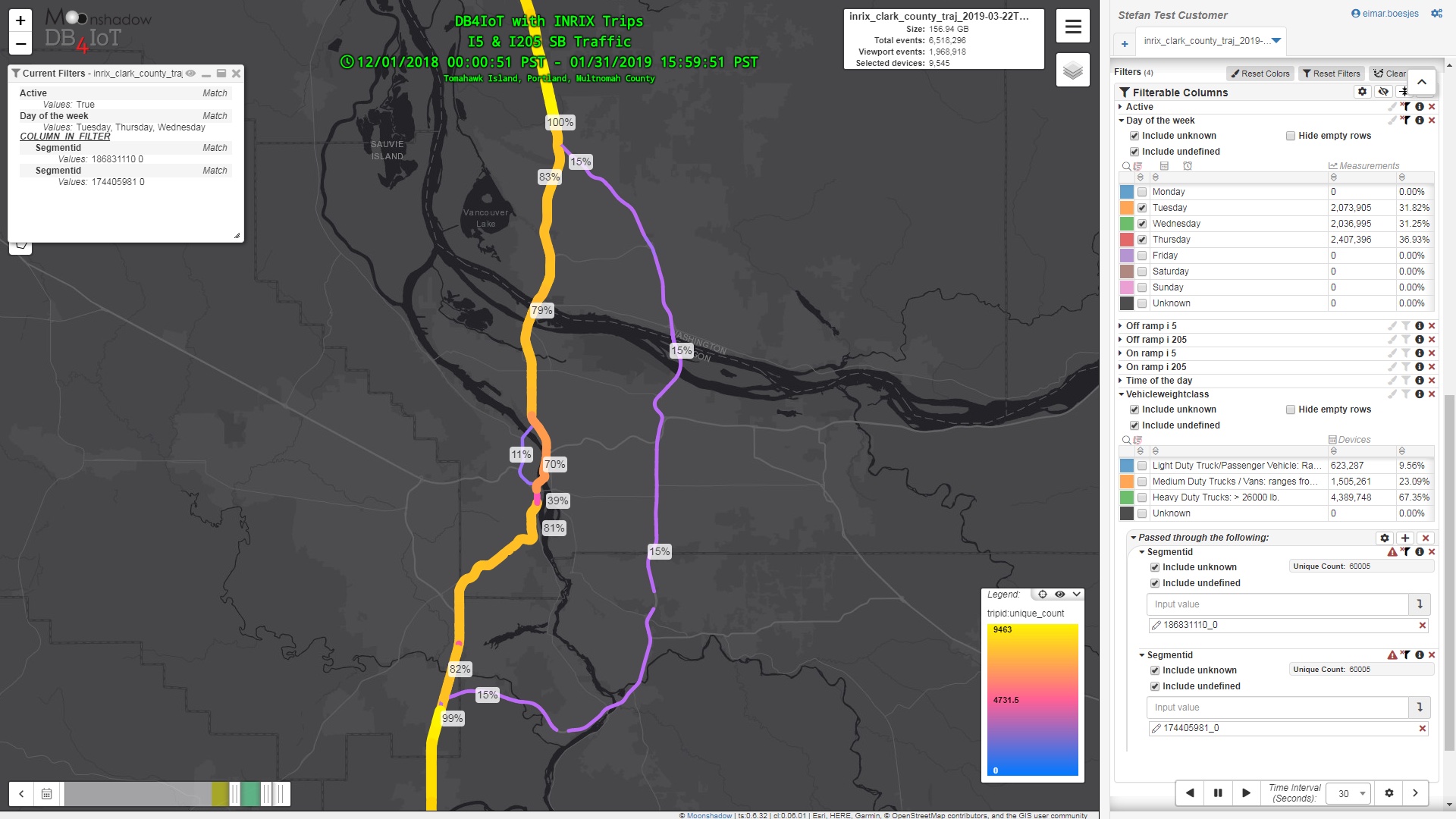
INRIX has announced a new addition to the INRIX Trips family of products: INRIX Trip Paths. INRIX now has two products that deliver detailed connected vehicle data; INRIX Trip Reports and INRIX Trip Paths. Moonshadow Mobile’s DB4IoT uses the connected vehicle data from INRIX to power DB4IoT, the analytics platform for traffic engineers. In 2018 Moonshadow released DB4IoT with INRIX Trip Reports. Today Moonshadow is releasing DB4IoT with INRIX Trip Paths.

Moonshadow Mobile works closely with DKS Associates in Portland, OR to create the exact features that traffic engineers need and DKS uses DB4IoT in its traffic engineering practice. In March […]

INRIX Trip Reports vs. INRIX Trip Paths

By |May 30th, 2019|

Three years ago, INRIX introduced INRIX Trips, also known as INRIX Trip Reports. INRIX Trip Reports provides accurate insight into the trips people take, including where they begin and end their journeys and all the waypoints in between. There are three types of points in the INRIX Trip Reports data; origin points, waypoints and destination points. Trips start at an origin point, generate data at a number of waypoints and end at a destination point. The INRIX Trip Reports data can be used to analyze movement patterns, generate origin/destination matrices and perform select link analysis in tools such as DB4IoT […]

Generate Freeway Origin-Destination Matrices Interactively In DB4IoT with INRIX Trips

By |May 16th, 2019|

There are three types of points in the INRIX Trips data; Origin points, Waypoints and Destination points. Trips start at an origin point, generate data at a number of waypoints and end at a destination point. In DB4IoT with INRIX Trips you can select all waypoints on a specific road and generate an Origin-Destination Matrix for all trips passing through that road. In addition, the platform provides routing information (via waypoints) that visualize the route that was used by a trip.

If you manage a freeway system you are interested in trip routing details, rather than […]

NYC Motor Vehicle Collisions Data in DB4IoT

By |April 10th, 2019|

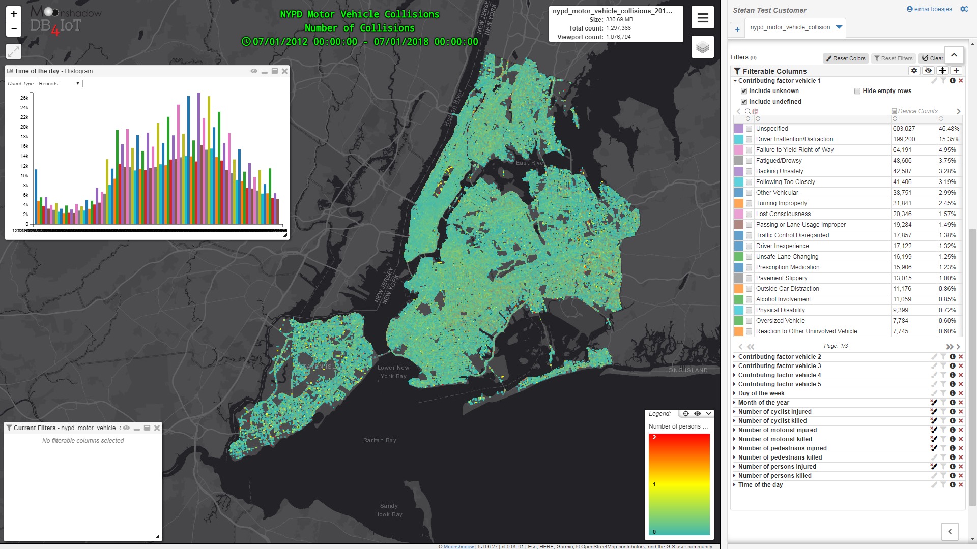
The NYC Open Data portal provides an interesting data set from the NYPD that is a breakdown of every motor vehicle collision in NYC by location and injury. Each record represents a collision in NYC by city, borough, precinct and cross street. This data can be used by the public to see how dangerous/safe intersections are in NYC.

We imported the data into the DB4IoT analytics platform to visualize the six-year period from July 2012 through June 2018. The following series of images detail the results. Public data sets such as this can be combined in DB4IoT with transportation, traffic, smart-city […]

NYPD Open Data: Motor Vehicle Collisions Analytics in DB4IoT

By |April 10th, 2019|

The NYC Open Data portal provides an interesting and useful data set from the NYPD that is a breakdown of every collision in NYC by location and injury. This data is manually run every month and reviewed by the TrafficStat Unit before being posted on the NYPD website. Each record represents a collision in NYC by city, borough, precinct and cross street. This data can be used by the public to see how dangerous/safe intersections are in NYC.

We imported the data into DB4IoT, our time-series database engine and analytics platform for the Internet of Moving Things, to visualize the six-year […]

ITS Washington Annual Meeting Presentation – Using Connected Vehicle Data to Estimate Greenhouse Gas Emissions

By |December 19th, 2018|

Eimar Boesjes, Moonshadow CEO, delivered a technical presentation at the ITS Washington annual meeting on December 11th, 2018 in Seattle.

Estimating vehicle emissions from connected vehicle data does not replace existing environmental models, roadside emissions measurements or environmental models. Rather, it augments these. We think it would be extremely interesting to compare the emissions estimates from DB4IoT with INRIX Trips with actual measurements from roadside air quality measurements, with emissions calculations from gasoline sales and with the existing environmental models. These different approaches each give a different insight and they can be used to ‘ground truth’ each other.

For additional background information […]