Data Mapping & Visualization

Ground Game 2: Disaster Response

By |August 12th, 2013|

The frequency and intensity of natural disasters has been on the rise for the past couple decades, and scientists are reporting this trend is likely to continue. This trend has contributed to an increase in damage to infrastructure and only complicated the efforts of emergency groups to adequately respond to these events. With wildfire season upon us and hurricane season yet to come, there is an ever increasing need to effectively respond to natural disasters. Therefore, it is important for emergency response groups to have reliable on the ground information, so that people and supplies can be sent to the correct locations, and that triage can be implemented effectively in an organized manner.

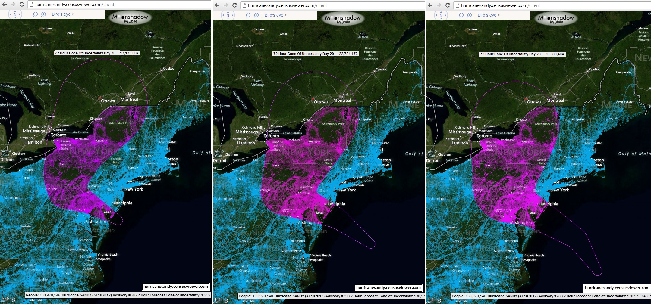
Fortunately, Web 2.0 technologies such as Volunteered Geographic Information (VGI) applications provided emergency groups and agencies with the tools needed to efficiently collect a massive amount of real time field data. Although these applications have many positive attributes, the lack of quality control in the data has been a long standing issue. This is where Moonshadow Mobile’s Ground Game 2 application comes in.
[…]

Big Data + Open Government = Big Opportunity

By |March 23rd, 2012|

Government agencies are releasing data in quantities never seen before. At the federal level the Census, the Bureau of Labor Statistics, the EPA, the CDC, the Weather Bureau, the USGS and dozens of other agencies are releasing hundreds of millions of records annually, each. State and local government agencies are following suit. Private industry, as well, is making data more accessible than ever before. Just think about the map and image data that is available through Google Maps, Bing Maps or OpenStreetMaps. Inexpensive access to Big Data will take the availability of information to the next level.

Moonshadow COO/CTO Eimar Boesjes […]

Census Data

By |January 14th, 2011|

We’ve just added the Census 2000 data for all seven million census blocks and will add the Census 2010 block level data shortly after its release by the US Census Bureau in late March.  This makes possible quick and easy access to demographic information via an intuitive user interface that encourages analysis and better understanding of shifting trends.  It facilitates invaluable tools for planners, demographers, social scientists, architects, real estate professionals, marketers, politicians and anyone else interested in the specifics of the population of the US.

Generate images showing all of the approximately 300 million people in the US.  The data […]