Eimar M. Boesjes, CEO, Moonshadow Mobile
Joshua Skov, Industry Mentor, Lundquist College of Business, University of Oregon
October 26, 2018
What does the carbon footprint from transportation look like? In particular, how could you map it?
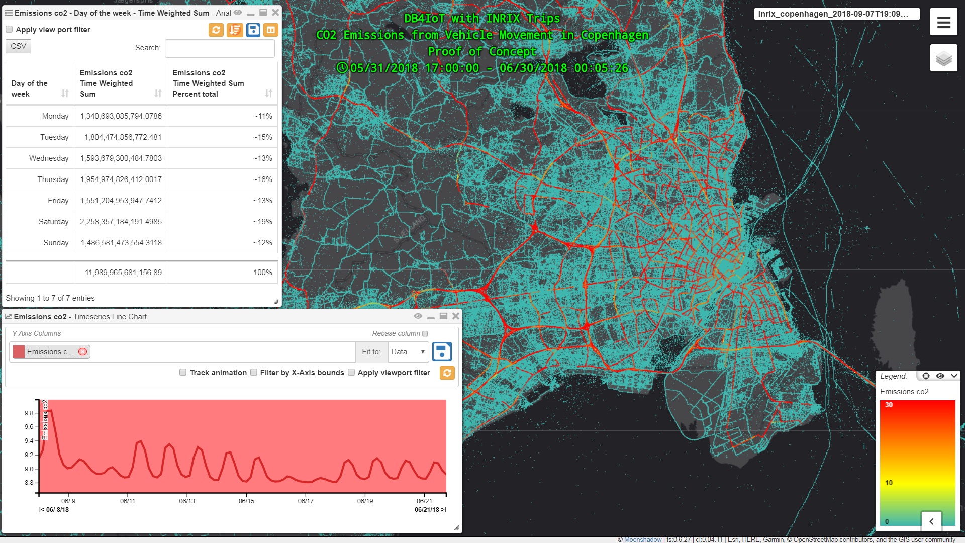
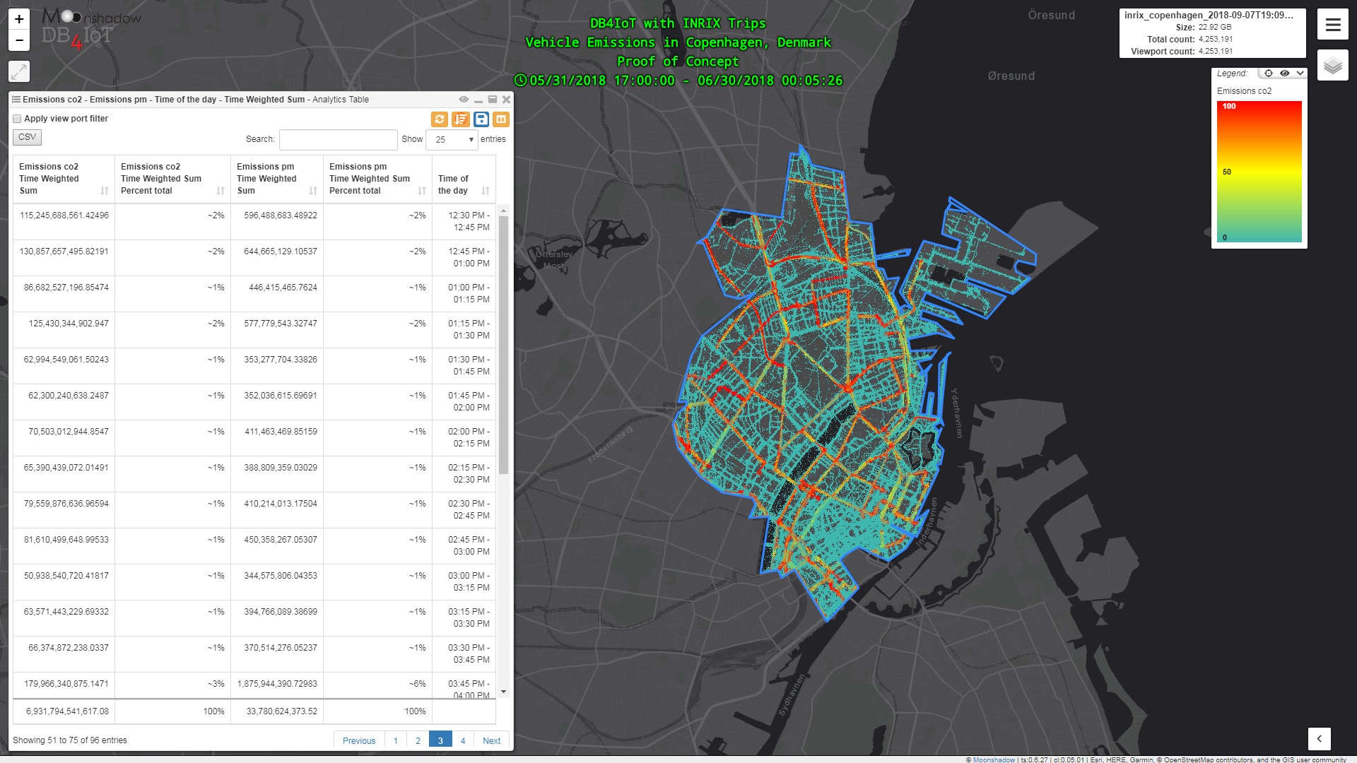
Typically, carbon footprinting exercises for local and regional jurisdictions deliver highly aggregated results. Even when the unit of analysis is geographic, the data is all about pie charts and tables. The results for New York City are…for all of New York City. Meaningful and important, but it leaves us missing something truly geographic in nature. Moonshadow Mobile recently completed a proof of concept (PoC) to derive greenhouse gas emissions estimates using measured vehicle movement data for Copenhagen, Denmark. This shows the spatial presentation of greenhouse gas emissions from on-road sources. In addition to presenting results in a “heat map” style, it’s possible to see these results in ways that have inherently spatial meaning, such as with origin-and-destination matrices.
Moonshadow Mobile has developed DB4IoT, a database engine built specifically for tracking data from moving objects such as vehicles. With DB4IoT, databases with hundreds of millions of waypoint records can be mapped and graphed in seconds. INRIX is a company that collects data from moving vehicles to provide real-time information for car navigation systems. Moonshadow Mobile and INRIX have teamed up to create DB4IoT with INRIX Trips, a software platform that allows customers to quickly analyze data from millions of trips. Every trip consists of an origin point, a number of waypoints and a destination point. INRIX tracks the day, time, vehicle weight class and speed for every waypoint. The result is a database with hundreds of millions of waypoints that documents vehicle movement in detail. Moonshadow used the INRIX trips data for all vehicles that originated, ended or passed through the City of Copenhagen in the month of June 2018. This database contained 120 million waypoints.
INRIX tracks connected vehicles that use its services, so they only have a percentage of all vehicles and we needed a way to scale INRIX’s data to estimate the entire fleet of vehicles going through Copenhagen. The Danish Road Directorate provided us with average annual daily traffic (AADT) for each road segment and we used this to scale the INRIX movement data to an estimate of all movement data in the city for every second of the month. Next we used emissions tables to look at the amount of CO2, CO, NOx and particulate matter (PM) that vehicles emit per second at different speeds. We did not have detailed information about the composition of the car fleet in Copenhagen so we constructed a rough estimate from European averages for both light-duty and heavy-duty vehicles. We attached the per-second emissions data to every waypoint for every trip resulting in an emissions database of moving vehicles. This was the basis for our analytics.
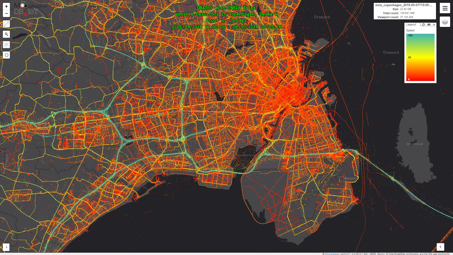
Step 1. Load the INRIX Trips data in DB4IoT. Every dot is one vehicle reporting its position and speed at a specific moment in time. Speed is shown in kilometers per hour (km/h).
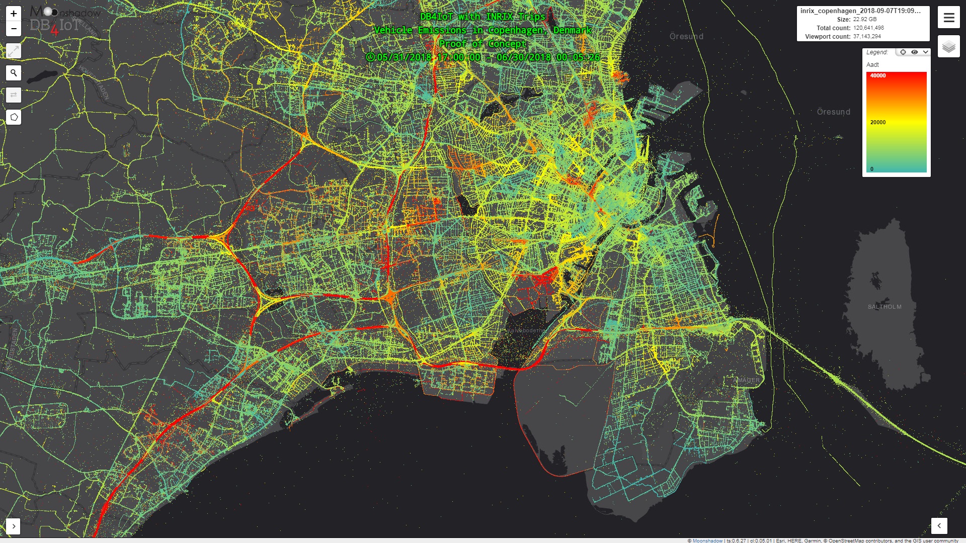
Step 2. Combine the INRIX Trips data with the Average Annual Daily Traffic from the Danish Road Directorate. Every dot now represents a number of vehicles. Traffic volume is shown as number of vehicles per day.
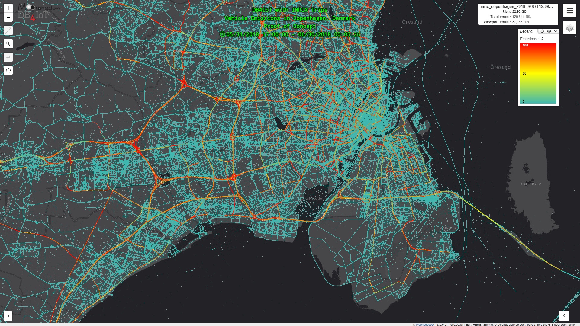
Step 3. Calculate the amount of emissions per second for all moving vehicles for each compound. Every dot now represents the amount of CO2 emitted by a number of vehicles. CO2 emissions are shown in grams per second.
INRIX provides the speed that the vehicle has the microsecond that it reported this. We used the point-to-point speed instead. For every waypoint we calculated the distance traveled from the previous waypoint and divided this by the drive time to get the point-to-point speed. This is less accurate if the waypoints are further apart and vehicles travel around corners. We did not snap the vehicles to the road network and calculate the actual distance traveled which would lead to more exact data.
We time-weighted all the movement data. This technique ensures a continuous emissions estimate, even with inevitably intermittent waypoint data. If a vehicle was traveling at 50 km per hour at a certain waypoint we assumed it would continue at that speed until a next waypoint was reached. With this assumption we could calculate the amount of emissions of all vehicles on a second-by-second basis. By generating a time-weighted database of all vehicle movement we were able to map, chart and enumerate any type of emission at any level of detail in time and space. The more frequently vehicles report their position and speed, the more exact the movement data is and the more accurate the emissions estimates.
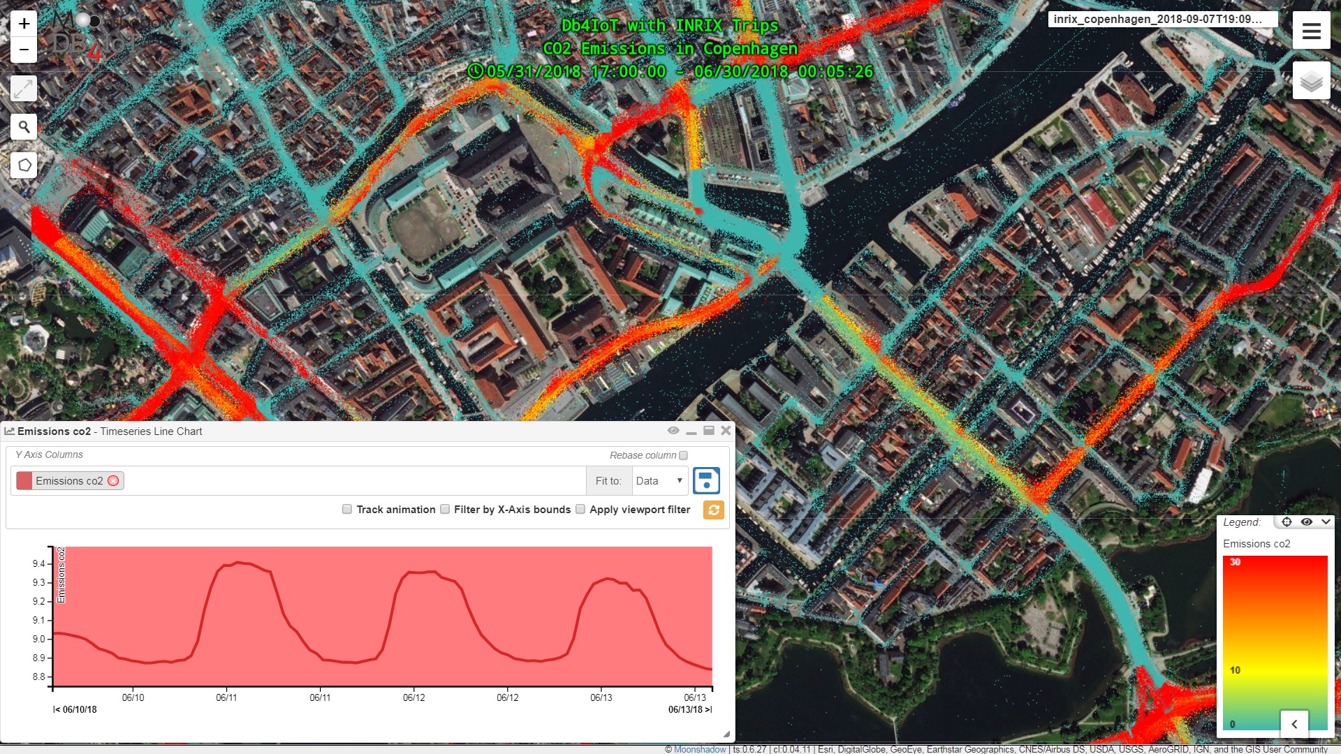
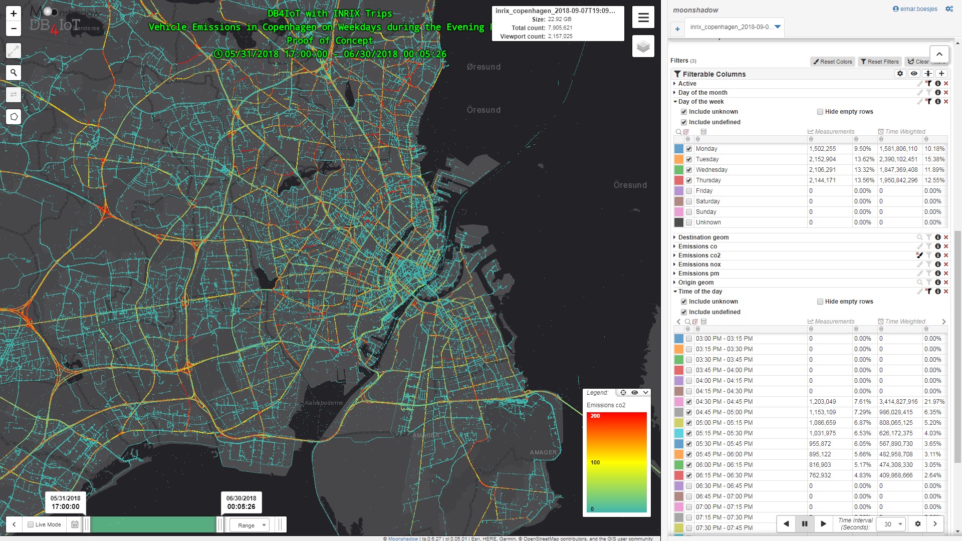
DB4IoT with INRIX Trips includes a map-based user interface. You can zoom and pan to any area of the city, select any time period or vehicle weight class and generate maps, charts or graphs for any compound. DB4IoT is a time-series database allowing you to select any time range. By selecting just the weekdays and the evening peak time of day you can look at evening peak emissions on weekdays.
Our approach makes no representation about what happens to the emissions. Do they go into the water, air or ground? We just estimate the amount of emissions over time and space. Traditionally greenhouse gas and pollution emissions use complex environmental models. Doing emissions estimates in DB4IoT with INRIX Trips does not use any complex model. It is a relatively simple calculation. If you have X number of vehicles driving at Speed Y for Z seconds and they output an amount of Q in emissions per second then the emissions calculation is a simple multiplication: TotalEmissions = X * Y * Z * Q. We can refine the underlying data but the math itself is not in dispute.
Estimating vehicle emissions from connected vehicle data does not replace existing environmental models, roadside emissions measurements or environmental models. Rather, it augments these. We think it would be extremely interesting to compare the emissions estimates from DB4IoT with INRIX Trips with actual measurements from roadside air quality measurements, with emissions calculations from gasoline sales and with the existing environmental models. These different approaches each give a different insight and they can be used to ‘ground truth’ each other.
DB4IoT with INRIX Trips is available in 40 countries. The availability of traffic volume data differs on a country by country basis.
For more info or to schedule an online demo.
